From 28 Hours to Real Time: How Alaska Uses Armada to Turn Drone Data into Decisions
The Alaska Department of Transportation and Public Facilities (Alaska DOT&PF) operates across some of the harshest terrain on earth. The agency is responsible for thousands of miles of highways, 237 rural airports, two international airports, and the Alaska Marine Highway System.
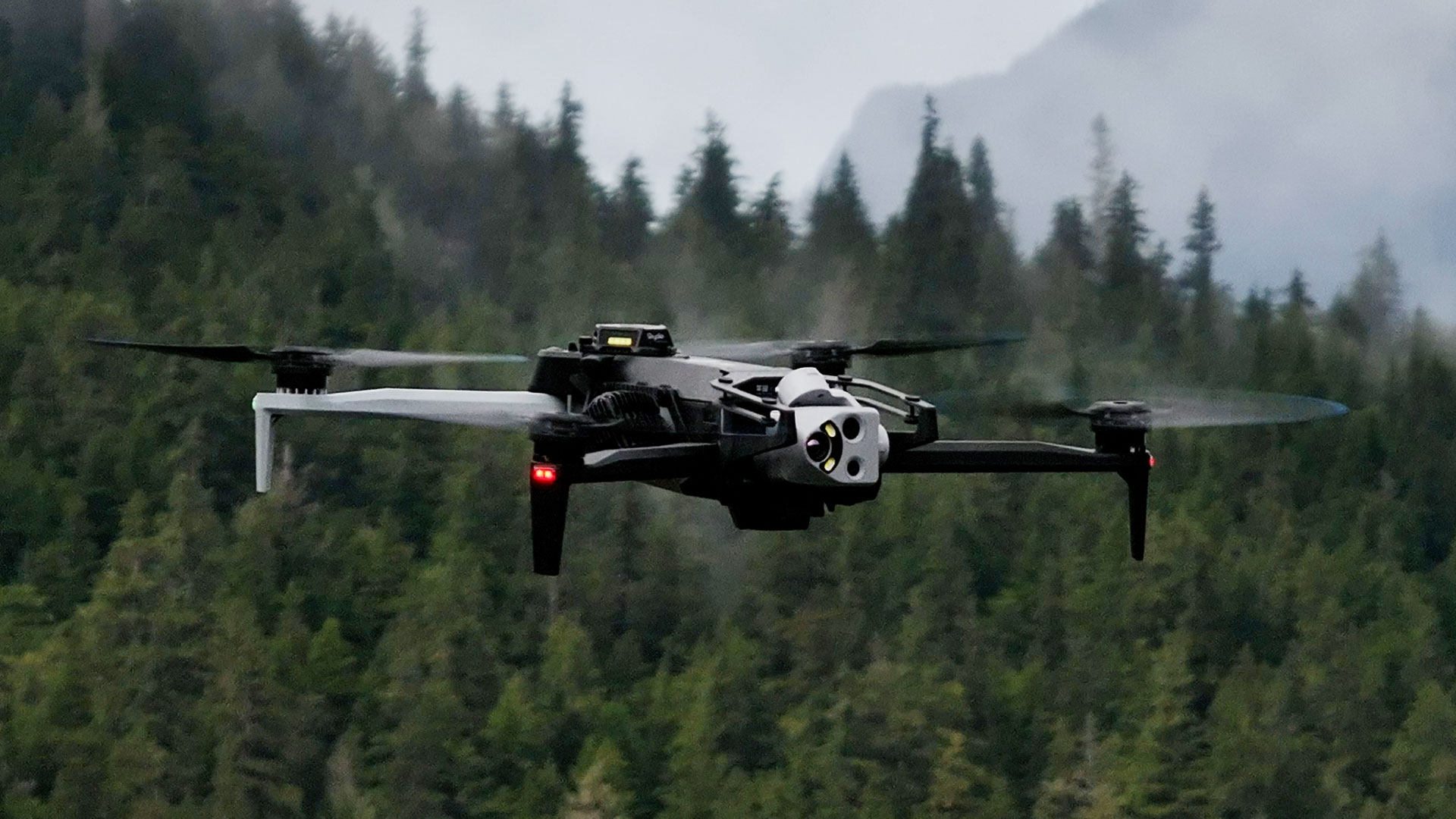
On top of daily operations, Alaska DOT&PF must constantly monitor and respond to landslides, avalanches, rockfalls, flooding, and other life-threatening events. They rely on drone imagery and geospatial workflows to understand what is happening on the ground and to decide where to send crews, what to close, and how to keep people safe.
For years, the data they needed was locked behind one problem: latency.
This is how Alaska DOT&PF moved from a world where it could take over 28 hours to turn imagery into insight, to a world where decisions can be made in near real time using Armada Edge Platform (AEP).
Before Armada: Driving Memory Cards into Town
Alaska does not have large regional data centers. Heavy processing historically lived in distant cloud regions with limited bandwidth connecting remote sites to those regions.
The workflow looked like this:
- Fly drone missions over a landslide, avalanche path, floodplain, or critical asset
- Fill memory cards with terabytes of high-resolution imagery
- Physically drive those memory cards from the field into the nearest city with fast enough internet
- Upload the data to the cloud for processing
- Wait for terrain models, surface models, and 3D products to finish processing
The drive, the upload, and the remote processing all added up. From landing the drone to receiving usable products, the team often waited 28 hours or more. In some cases, the delay stretched into weeks.
For seasonal planning, that latency is painful. For an active disaster, it is a liability. Crews are already in the field while decision makers are still waiting for the data they need.
Phase One: Atlas Cut Latency From 28 Hours to 4 Hours
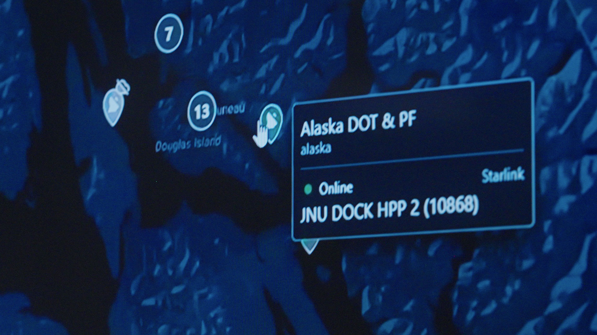
Alaska DOT&PF deployed Atlas to standardize connectivity at the edge and to make satellite backhaul via Starlink a fully managed part of their infrastructure. Atlas gives the department:
- A single pane of glass for all connected assets
- Centralized procurement and management of Starlink terminals
- Real-time visibility into where terminals and field systems are located
- A live map of coverage and gaps so they can pre-position connectivity before events
Today, Alaska DOT&PF has close to 300 connected assets in Atlas. Terminals, drones, and other edge systems across the state report health, status, and location back into one operational view.
When an emergency occurs, the team can see where bandwidth already exists, where it is missing, and how to move assets into place quickly. Instead of driving memory cards into town, imagery can be streamed or uploaded from the field over satellite.
That shift alone reduced processing latency from roughly 28 hours down to around four hours for many missions. The same day an event occurs, updated models and imagery can be available to planners and incident commanders.
Four hours is a step change. It proves that connectivity is not just a convenience for remote operations. It is the foundation for everything that comes next.
Phase Two: Galleon Brings Compute to Alaska
Connectivity solved the transport problem. The remaining bottleneck was distance to compute. Even with faster uploads, pushing terabytes to remote cloud regions and waiting for processing introduced unsustainable delays.
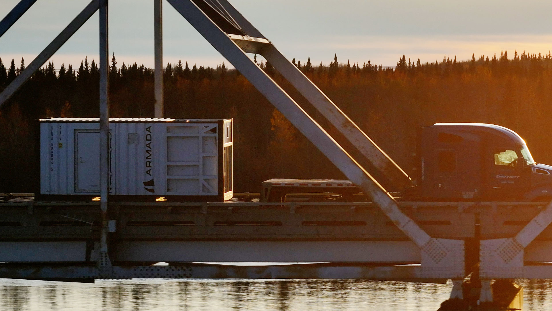
To remove that dependency, Alaska DOT&PF brought on-prem compute to Alaska.
There are now two Galleons powering their geospatial workflows:
- An on-prem edge cluster at the Remote Sensing Lab in Anchorage, running AEP inside an existing facility.
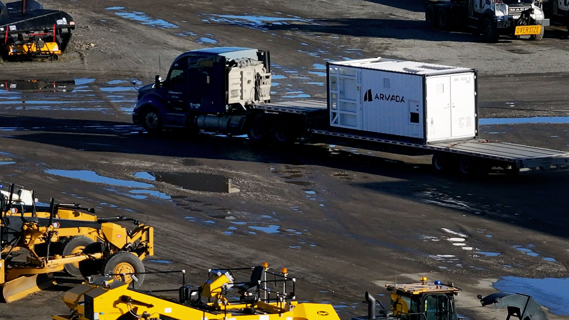
- Cruiser in Fairbanks, a 20-foot Galleon modular data center with integrated power, cooling, and compute, deployed where it can serve northern operations.
Both environments run on Armada Edge Platform (AEP). Both are designed to process data where it is created instead of shipping it away. The two environments also serve as failover for each other, maximizing resiliency for Alaska DOT&PF’s operations.
With Galleon, Alaska DOT&PF can:
- Ingest live drone feeds directly into local compute
- Run their geospatial and analytics workloads where the data is generated
- Generate terrain models, surface models, point clouds, and 3D products locally
- Apply AI to classify hazards and prioritize response while teams are still on site
Workflows that once required driving memory cards into town and waiting a day or more for cloud processing now complete in near real time once the data hits Galleon.
For the remote sensing team, the difference is concrete. Early in the program, it could take an entire season to fully produce certain products. In the pure cloud era, they pushed that down to roughly 28 hours. With Atlas + Starlink, they moved to around four hours. With Galleon, they are now operating in minutes.
Most recently, following Typhoon Halong, the Armada stack enabled Alaska DOT&PF to assess damage across more than $200 million in assets in just weeks. This level of speed was not possible before drone photogrammetry and edge computing powered by Armada Edge Platform.
How the Architecture Works Together
The gains in latency and speed to decision come from the way the stack fits together.
Atlas for statewide visibility Atlas is the live map for Alaska DOT&PF’s edge. It shows where terminals, drones, and edge systems are deployed. It monitors their health and status. It highlights coverage gaps and makes it easy to move connectivity into place ahead of storms or in response to incidents.
Galleon for local compute Galleon in Anchorage and Fairbanks turn Alaska into an edge compute region. Instead of depending on distant data centers, the department has its own AI and processing capacity in state, under its control, running AEP.
Existing tools, new performance envelope On top of this infrastructure, Alaska DOT&PF runs its existing drone, mapping, and GIS toolchain. Drone platforms capture high-resolution imagery. Geospatial software generates elevation models and 3D meshes. Partners such as Skydio and ESRI are directly available on the Armada Marketplace and their software can be deployed to Galleon seamlessly.
Armada provides the connectivity, compute, control plane, and Marketplace that make the entire system work as one.
From Data to Decision
The real impact for Alaska DOT&PF is not just faster processing. It is faster and better decisions in high-risk environments.
With AEP in place, the department can:
- Determine which slopes, roads, or runways are at greatest risk while teams are still deployed
- Decide what to close, where to send crews, and how to stage equipment based on current data, not yesterday’s snapshot
- Support search and rescue missions with up-to-date terrain information and imagery
- Coordinate response across a state where a single road, village, or landing strip may be separated by hundreds of miles from the next
- Complete damage assessments in days or weeks instead of months or years
Speed to decision moves from days, to hours, to minutes. That does more than improve efficiency. It changes outcomes.
What This Means for Other Remote Operators
Many operators in remote, infrastructure-constrained, or disaster-prone environments face the same pattern Alaska DOT&PF started with:
- Data trapped on local devices
- Slow or unreliable paths to the cloud
- Limited visibility into where connectivity and compute exist
- Long delays between capture and action
The Alaska deployment shows a clear path forward:
- Use Atlas to manage all edge connectivity and terminals in one place and to understand where you have coverage
- Bring Galleon modular data centers close to your data sources
- Run your existing analytics, GIS, or AI workloads on AEP at the edge instead of waiting on distant cloud regions
The outcome is the same pattern Alaska DOT&PF is seeing. Less latency. More awareness. Faster decisions.
To learn more about how Armada can reduce latency and increase your speed to decision, contact us.
